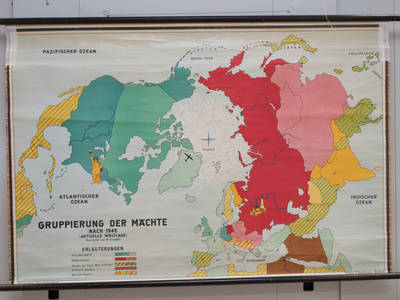
Schulwandkarte "Gruppierung der Mächte nach 1945"
P - Karten und Pläne, 1960 - 1980
P-000587
Suche nach: | 1966 - 1980
18 Digitalisate
Filter
Typ
Sammlung 1
Bild vorhanden
Materialien
Schlagwort
Karte (8)
Bauzeichnung (4)
Skizze (4)
Wachtturm Typ BT-11 (4)
Flucht (3)
Tragschrauber (3)
Bauplan (2)
Exklave Eiskeller (2)
Grenze (2)
Straßenkarte (2)
Datierung 1
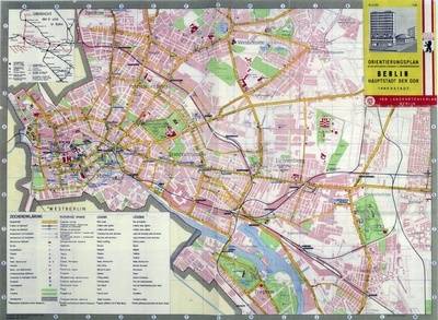
Ost-Berliner Innenstadt mit eingezeichneten Sehenswürdigkeiten und S- und U-Bahnnetz
P - Karten und Pläne, 1961 - 1969
P-000478
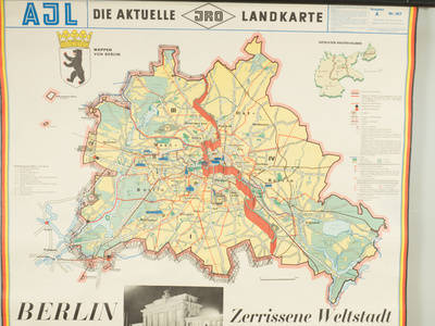
Schulkarte Berlin "Zerrissene Weltstadt"
P - Karten und Pläne, 1961 - 1971
P-000586
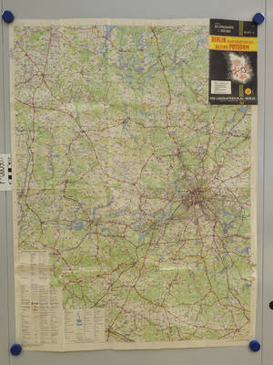
Bezirkskarte Berlin Hauptstadt der DDR mit Bezirk Potsdam
P - Karten und Pläne
P-000588
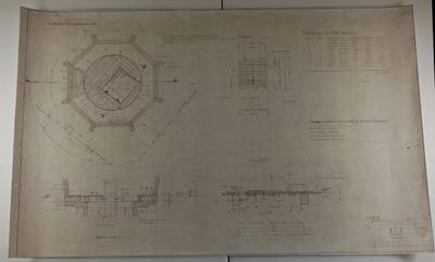
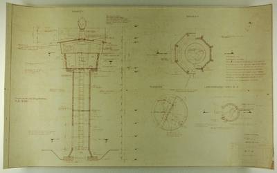
Konstruktionsskizze und Aufsicht für einen Wachturm Typ BT-11
P - Karten und Pläne, 1967
P-000530
Vorlagerungsplan Wachturm Typ BT-11
P - Karten und Pläne, 1967
P-000531
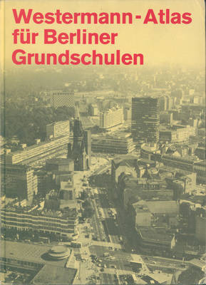
Atlas für Berliner Grundschule
P - Karten und Pläne, 1968
P-000598
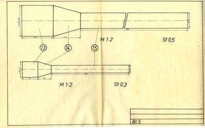
Bauzeichnung für die Brennkammer eines Tragschraubers
P - Karten und Pläne, 1970 - 1972
P-000547
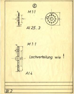
Bauzeichnung des Ventilträgers und der Andruckplatte eines Tragschraubers
P - Karten und Pläne, 1970 - 1972
P-000548
Bauzeichnung der Brennkammer mit Rohr eines Tragschraubers
P - Karten und Pläne, 1970 - 1972
P-000549
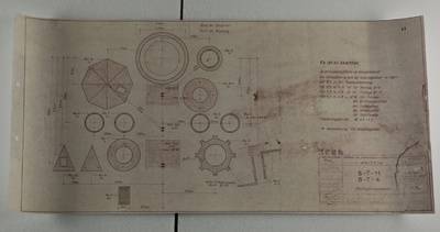
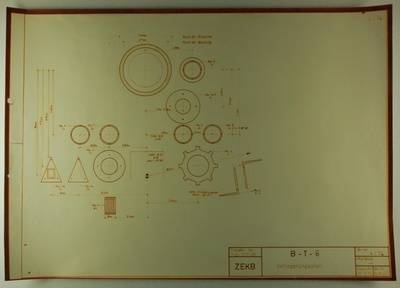
Bauzeichnung und Querschnitte vom BT-11
P - Karten und Pläne, 1974
P-000528
Verlagerungsplan für Wachturm Typ BT-11
P - Karten und Pläne, 1974
P-000529
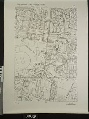
Karte vom Außenring um den Bahnhof Staaken, Berlin (West)
P - Karten und Pläne, 1974
P-000559
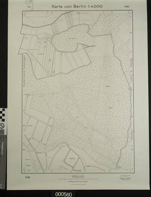
Karte von Berlin-Spandau mit Exklave Eiskeller
P - Karten und Pläne, 1975
P-000560
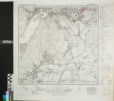
Karte des Potsdamer Staatsforstes
P - Karten und Pläne, 1977
P-000561
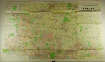
Stadtplan von Berlin, Hauptstadt der DDR
(mit Straßenverzeichnis)
P - Karten und Pläne, 1978
P-000332